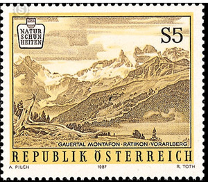
nature - Austria / II. Republic of Austria 1987 - 5 Shilling
Theme: Geology & Geography
| Country | Austria / II. Republic of Austria |
| Issue Date | 1987 |
| Face Value | 5.00 |
| Color | brown |
| Printing Type | combination printing |
| Stamp Type | Commemorative |
| Item Type | Stamp |
| Chronological Issue Number | 1239 |
| Chronological Chapter | OOS-OE2 |
| SID | 838851 |
| In 73 Wishlists | |
The Gauertal is a small side valley in the internationally known high mountain valley Montafon, which forms a unique closed habitat. The brand image shows the view of the central Rätikongebirge with Sulzfluh, Drei Türme and Drusenfluh, all about 3,000 m high. You can also see the broad depression in between, the Drusentor, as one of the passes leading to the neighboring Swiss town of Prättigau. The mountains described by the geographers as the "Eastern Alps Group of the Central Alps", which is already recorded as Rhetico mons in historical maps of 1552 and 1712, runs with its 40 km long main ridge between 2,500 m and 3,000 m in the Rhine Valley near Feldkirch and pervades the three states Austria, Switzerland and Liechtenstein. The Gauertal begins in the village of Tafurguns in the village of Montafon, opposite the main town of Schruns. It hides first in a gorge off the road with the once dreaded torrent Rasafei. At an altitude of 1000 m, with wonderful views over the valley and far away, lies the scattered Latschau mountain settlement with its reservoir. But only at 1,200 m altitude is the Gauertal suddenly opened, unfolded wide, it lies in wonderful beauty in front of the viewer spread with its meadows, Alpine mats and forests.


