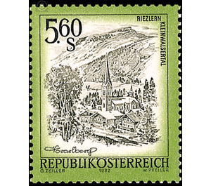
landscapes - Austria / II. Republic of Austria 1982 - 5.60 Shilling
Theme: Geology & Geography
| Country | Austria / II. Republic of Austria |
| Issue Date | 1982 |
| Face Value | 5.60 |
| Color | multi-colored |
| Printing Type | combination printing |
| Stamp Type | Definitive |
| Item Type | Stamp |
| Chronological Issue Number | 1054 |
| Chronological Chapter | OOS-OE2 |
| SID | 974870 |
| In 67 Wishlists | |
In the northeast of the Austrian province of Vorarlberg, nestled in the southwestern foothills of the Allgäu Alps, is the valley of the Breitach, the Kleinwalsertal. The thirty mountain peaks between 1,800 and 2,500 m are surrounded by a horseshoe shape, one of the most beautiful regions in Austria, which covers almost 97 km in its natural limits and is 16 km long. The Great Widderstein (2,536 m) dominates the country far into the Swabian - Bavarian plateau. The Breitach, the source river of the Iller, drains the valley in a northeasterly direction. In its headwaters, it leaves the settlement grounds in order to dig itself deeper and deeper into the soil in an idiosyncratic run below the three villages Mittelberg, Hirschegg and Riezlern. For centuries, the wild waters have created the Breitachklamm, the mightiest natural wonders in southern Germany. At Oberstdorf in the Allgäu, the Breitach, united with Stillach and Trettach, flows as Iller into the Danube. From the home country of Vorarlberg, the Kleinwalsertal can only be reached via high mountain passes.


